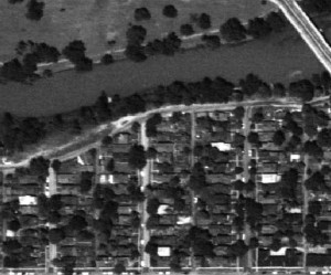
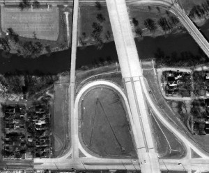
Urban Indy, a collaborative blog focused on urban design in Indianapolis, features an excellent post this week on a residential neighborhood that was wiped off the map by the construction of Interstate 65. The author, Chris Corr, uses aerial photos archived by the city — and easily accessible online — to show how a neighborhood nestled along Fall Creek and adjacent to Boulevard Place (the street on which my wife and I bought our first home) was transformed from tree-lined rows of homes to a blah blend of concrete and vacant spaces.
Not to decry the Eisenhower Interstate System, the benefits of which are significant. But Corr’s piece is valuable in that it forces you to consider that the mobility we enjoy is not without its costs. In this case, accessibility to Fall Creek was rendered challenging if not impossible, perfectly livable homes were razed, and, most importantly, families were forced to leave a seemingly scenic and pleasant neighborhood conveniently situated near downtown Indianapolis.

